

THE MAP PROYECTIONS
- teachersformation
- May 18, 2018
- 4 min read

Updated: May 21, 2018
PROJECTIONS – Defining terms and recognizing patterns.
A globe is the only “perfect” representation of the Earth’s surface. All maps are distorted in four major ways. The four ways maps are distorted is by the shape,area, distance, and direction of the landmasses being mapped. In order to make maps, projections must be made, and different projections require different distortions. For each projection listed below, complete the chart for the correct information.
1. ROBINSON PROJECTION MAP

Purpose: this kind of projection was created with the aim of solving the problem of representing the whole globe as a flat image, in order words, it wants to achieve a delightful effect when we see the world in a map. It was originally developed for a company.
Types of distortion: Robinson projection is distorted by the four ways (the direction, the shape, the distance, the area ).
Which areas are most distorted? The distortion close to the poles is severe, however, it rapidly decreases to moderate levels as we move away from them. Similarly, there is a severe angular distortion at the high latitudes toward the margins of the map and it is very serious within about 45° of the equator or within about 45° of the map’s central meridian.
There is more than one version? No, there is not.
Problems? The representation is not accurate due to the distorsions mentioned before, the curved meridians and the straight poles.
Socio-Cultural Implications of using it as a learning resource? Robinson projection has a better balance between size and shape of high-latitude lands. As a result, it offers an appearance of the world close to the reality.
2. MERCATOR PROJECTION

Purpose. This projection of the Earth's surface was designed for showing a flat surface (a two-dimensional representation) of a three-dimensional surface. It became the standard map projection for nautical navigation.
Types of distortion. Mercator projection distorts mainly the size of areas because the latitude increases from the Equator to the poles.
Which areas are most distorted? The poles, those area far away from the Equator, are the most distorted as the scale becomes infinite. Some examples are Greenland and Antarctica, that appear bigger than they actually are.
There is more than one version? Yes, the Transverse Projection is an adaptation of the Mercator Projection. It is widely used in international and national mapping systems around the world.
Problems? On the one hand, this projection gives people a false impression of the real size of world. On the other hand, it makes larger some continents and, consequently, it was beneficial for the colonial powers.
Socio-Cultural Implications of using it as a learning resource? As a result of the distorsion of the areas, people can think that some countries are more important than others depending on their sizes and their location on the map.
3. AZIMUTHAL PROJECTION

Purpose. The Azimuthal projection, also known as zenith projection, try to obatain the vision that would be achieved from the center of the Earth or from any other point of the space .
Types of distorsion. This projection distors the angles as well as the areas.
Which areas are most distorted? The areas far away from the centre of the plane are the most distorted.
There is more than one version? We can distinguish different versions according to the point inside or outside of the surface area: perspective projections ( Stereographic Projection, Ortographic Projection , Gnomonic Projection) or non-perspective projections ( Postel Azimuthal, Equidistant projection, Lambert Azimuthal equal area projection).
Problems? Although it can show the whole Earth, some distances and shapes are distorted away from the center of the plane.
Socio-Cultural Implications of using it as a learning resource? Azimuthal projection can teach children that the Earth can be viewed from different points. It is very useful for air and navigation routes.
COUNTRIES COMPARISON
We have chosen the Democratic Republic of Congo and Switzerland because both present a contrast that allows us to do a presentation with a wide range of information. Therefore, we are going to explain how these countries are represented in the different types of projections.

The Democratic Republic of the Congo is in Africa, next to Tanzania or Rwanda, among others, and above Angola and Zambia. In the Robinson Projection, it appears in the centre of the map. Africa is presented like a large continent through which we can find the Meridian and the Equator. In this way, we can say that the Republic of the Congo is nearby to them. Its size is very big, even more than other european countries such as Spain or United Kingdom. Therefore, we understand that the country has much importance within this type of projection. Although Africa is also big and located in the centre of the Mercator Projection, it is not as extended as in the previous kind of projection. However, in both cases, the Democratic Republic of the Congo has similar importance.
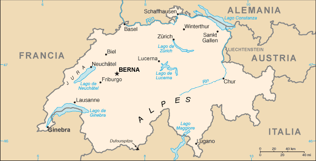
Regarding Switzerland, its appearance is very similar in Mercator and Robinson Projection. It is situated in the Western-Central Europe. Its size is smaller than the Congo, and it isn't so far away from the Meridian. Perhaps, this country is a bit distorted in Mercator Projection because it isn't very close to the Equator. In the Azimuthal Projection, the distortion of the countries depend on how far is from the center of the map. If we take the North Pole as the reference point, Swizterland is smaller than the Republic of the Congo. In addition, it is closer to the centre of the projection.


Comments